Trail Walking Les Monts d'Aunay - Aunay sur Odon - Photo
 tracegps
tracegps

User

© OpenStreetMap contributors
Length
Length
29 km
Max alt
Max alt
321 m
Uphill gradient
Uphill gradient
548 m
Km-Effort
Km-Effort  
36 km
Min alt
Min alt
121 m
Downhill gradient
Downhill gradient
552 m
Boucle
Boucle
No
Creation date :
2014-12-10 00:00:00.0
Updated on :
2014-12-10 00:00:00.0

(0 Reviews)

Walking
Walking
4h30
Difficulty : Difficult

Scan this QR Code to open this trail in the SityTrail application

FREE GPS app for hiking

Logo SityTrail SityTrail

IGN / Geographical institutes

Download SityTrail from the App Store Download SityTrail from Google Play

Logo SityTrail SityTrail World

The world is yours!

Download SityTrail from the App Store Download SityTrail from Google Play Download SityTrail on Huawei AppGallery

About

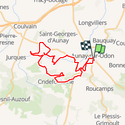
Trail Walking of 29 km to be discovered at Normandy, Calvados, Les Monts d'Aunay. This trail is proposed by tracegps.

Description

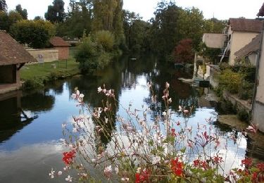
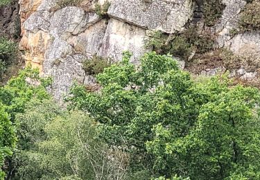
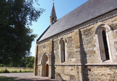
Au départ de la salle des fêtes d'Aunay, vous allez progresser le plus souvent à travers la plaine et parfois des champs. Ne pas hésiter parfois à franchir des clôtures (très original). Après un sympathique passage en foret, vous attend une belle montée sur bitume mais aussi une belle descente quelques kilomètres plus loin (descendre du vélo est recommandé). Une balade pour découvrir un aspect du bocage virois (ses haies, ses bois, ses maisons, sa campagne, ...) Bonne balade !

Elevation profile

Positioning

Country:
France
Region :
Normandy
Department/Province :
Calvados
Municipality :
Les Monts d'Aunay
Location:
Unknown
Start:(UTM)
673218 ; 5431978 (30U) N.

Trails nearby

Trail Mountain bike Les Monts d'Aunay - Boucle d'Aunay via Hamars - Photo
Mountain bike
tracegps

Mountain bike

Difficult
Les Monts d'Aunay, Normandy, Calvados, France
26 km | 33 km-effort
2h 0min
Yes
Trail Mountain bike Les Monts d'Aunay - L'Arbre de la Liberté  - Chartres - Photo
Mountain bike
tracegps

Mountain bike

Medium
Les Monts d'Aunay, Normandy, Calvados, France
2756 km | 3635 km-effort
3h 19min
No
Trail Mountain bike Les Monts d'Aunay - NormVass 2/6 7juin2022 - Photo
Mountain bike
thierryd

Mountain bike

Very difficult
Les Monts d'Aunay, Normandy, Calvados, France
47 km | 59 km-effort
8h 36min
No
Trail On foot Les Monts d'Aunay - Sous les monts d'Aunay - Photo
On foot
PRO

On foot

Easy
Les Monts d'Aunay, Normandy, Calvados, France
8 km | 9.4 km-effort
2h 7min
Yes
Trail On foot Malherbe-sur-Ajon - La Vallée de l'Ajon - Photo
On foot
PRO

On foot

Easy
Malherbe-sur-Ajon, Normandy, Calvados, France
14.4 km | 17.3 km-effort
3h 55min
Yes
Trail Walking Les Monts d'Aunay - ROUCAMPS  2 - Photo
Walking
lensois

Walking

Difficult
Les Monts d'Aunay, Normandy, Calvados, France
8.7 km | 11.2 km-effort
2h 52min
Yes
Trail On foot Le Mesnil-au-Grain - Petit Tour à Bauquay - Photo
On foot
PRO

On foot

Easy
Le Mesnil-au-Grain, Normandy, Calvados, France
4.3 km | 5.3 km-effort
1h 11min
Yes
Trail On foot Malherbe-sur-Ajon - Circuit de l'Orgueil - Photo
On foot
PRO

On foot

Easy
Malherbe-sur-Ajon, Normandy, Calvados, France
5.6 km | 6.6 km-effort
1h 30min
Yes
Trail On foot Les Monts d'Aunay - Sous le Mont d'Ancre - Photo
On foot
PRO

On foot

Easy
Les Monts d'Aunay, Normandy, Calvados, France
13.2 km | 17.3 km-effort
3h 55min
Yes


Close
My subscriptions